Projected state population in 2036
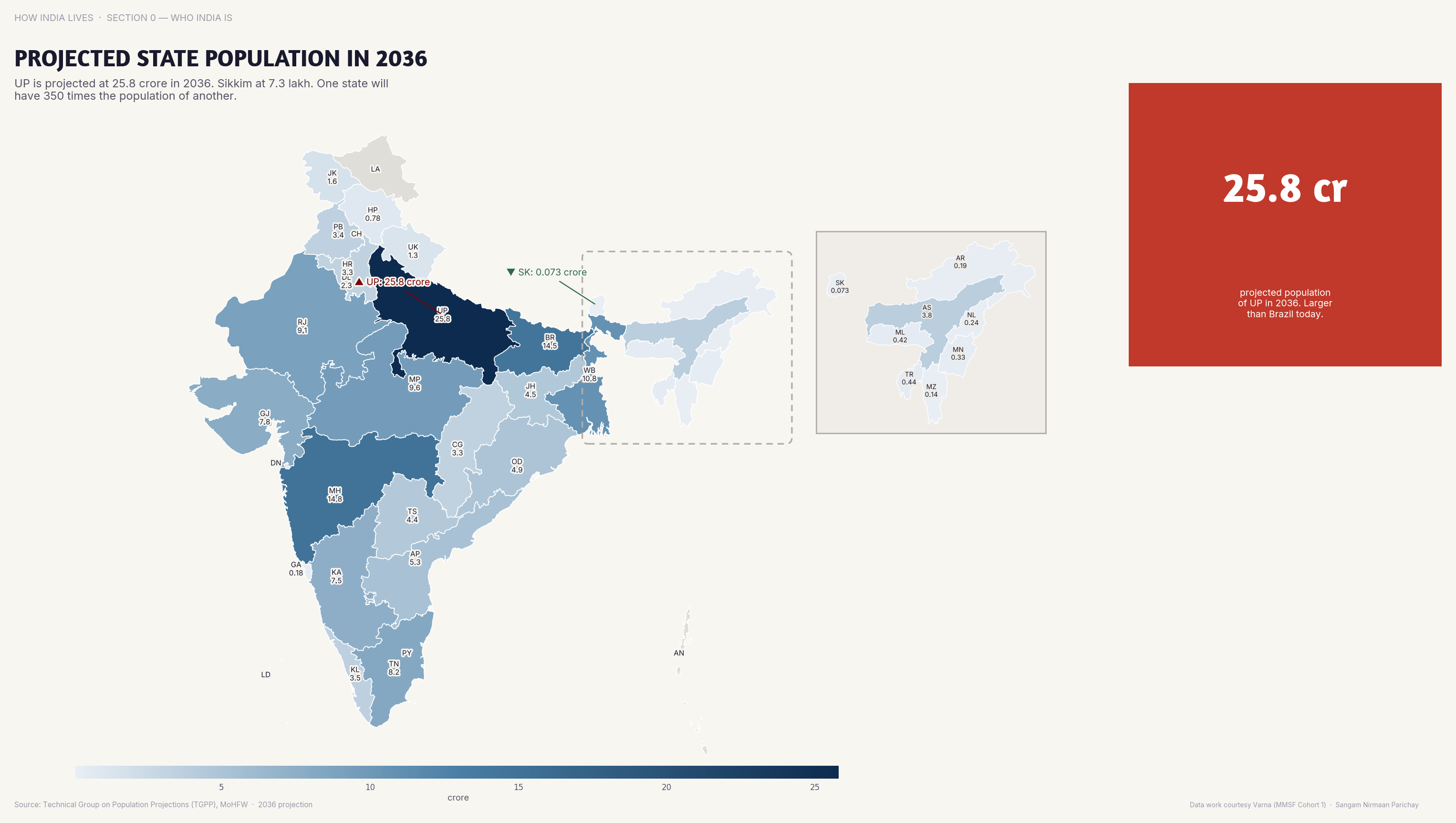
UP is projected to reach 260 million by 2036, larger than Brazil, while Kerala barely grows.
Policy implication
Delimitation based on 2036 projections will shift political power to high-fertility states that invested less in population control.
Delimitation based on 2036 projections will shift political power to high-fertility states that invested less in population control.
Data vintage. This map uses the 2011 Census, the latest published count by state and district. Populations and shares will have changed since.
Source: Census/NCP (2020). See the methodology for notes and limitations.
Part of ImpactMojo. Maps are pedagogical tools for facilitated discussion. For figures to cite, use the source publications. CC BY-NC-SA 4.0.