Flood-prone districts
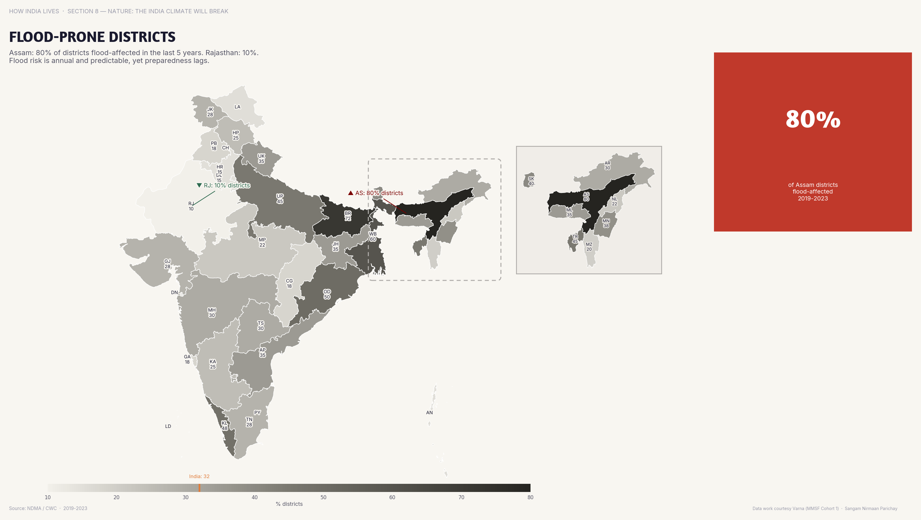
Assam, Bihar, and UP have the most flood-prone districts, along the Brahmaputra and Gangetic floodplain.
Policy implication
Flood-prone states need permanent flood management infrastructure as well as emergency relief every monsoon.
Flood-prone states need permanent flood management infrastructure as well as emergency relief every monsoon.
Data vintage. The figures are for 2023 and have not been refreshed since this map was made.
Source: IMD (2023). See the methodology for notes and limitations.
Part of ImpactMojo. Maps are pedagogical tools for facilitated discussion. For figures to cite, use the source publications. CC BY-NC-SA 4.0.