Women with low BMI, NFHS-6
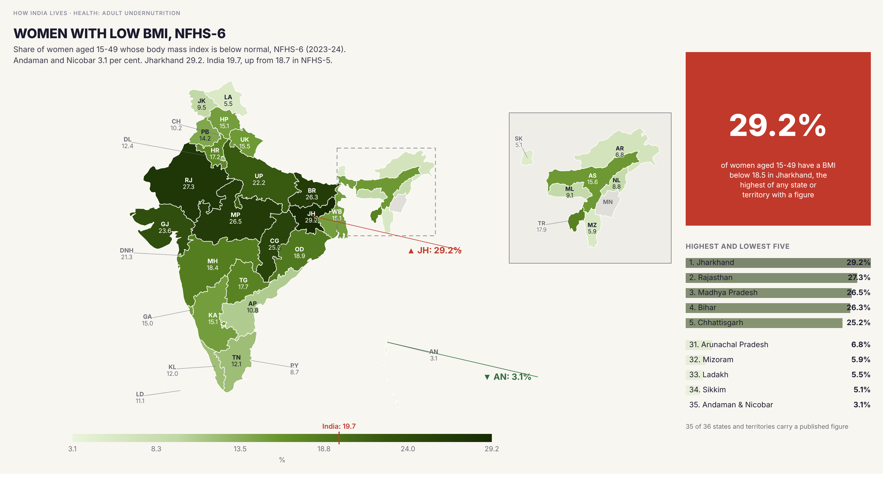
Women with bmi below 18.5 ranges from 3.1 per cent in Andaman and Nicobar to 29.2 per cent in Jharkhand. The India figure is 19.7 per cent, up from 18.7 in NFHS-5.
Policy implication
A BMI below 18.5 marks undernutrition in an adult woman, and it moves slowly between survey rounds.
A BMI below 18.5 marks undernutrition in an adult woman, and it moves slowly between survey rounds.
Data vintage. This map uses NFHS-5 (2019-21). NFHS-6 (2023-24) state fact sheets were released in May 2026, but they are provisional and report fewer indicators, so the figures here have not been replaced.
Source: NFHS-6 (2023-24) (2023-24). See the methodology for notes and limitations.
Part of ImpactMojo. Maps are pedagogical tools for facilitated discussion, not standalone data references. CC BY-NC-SA 4.0.