Annual rainfall by state, 2024
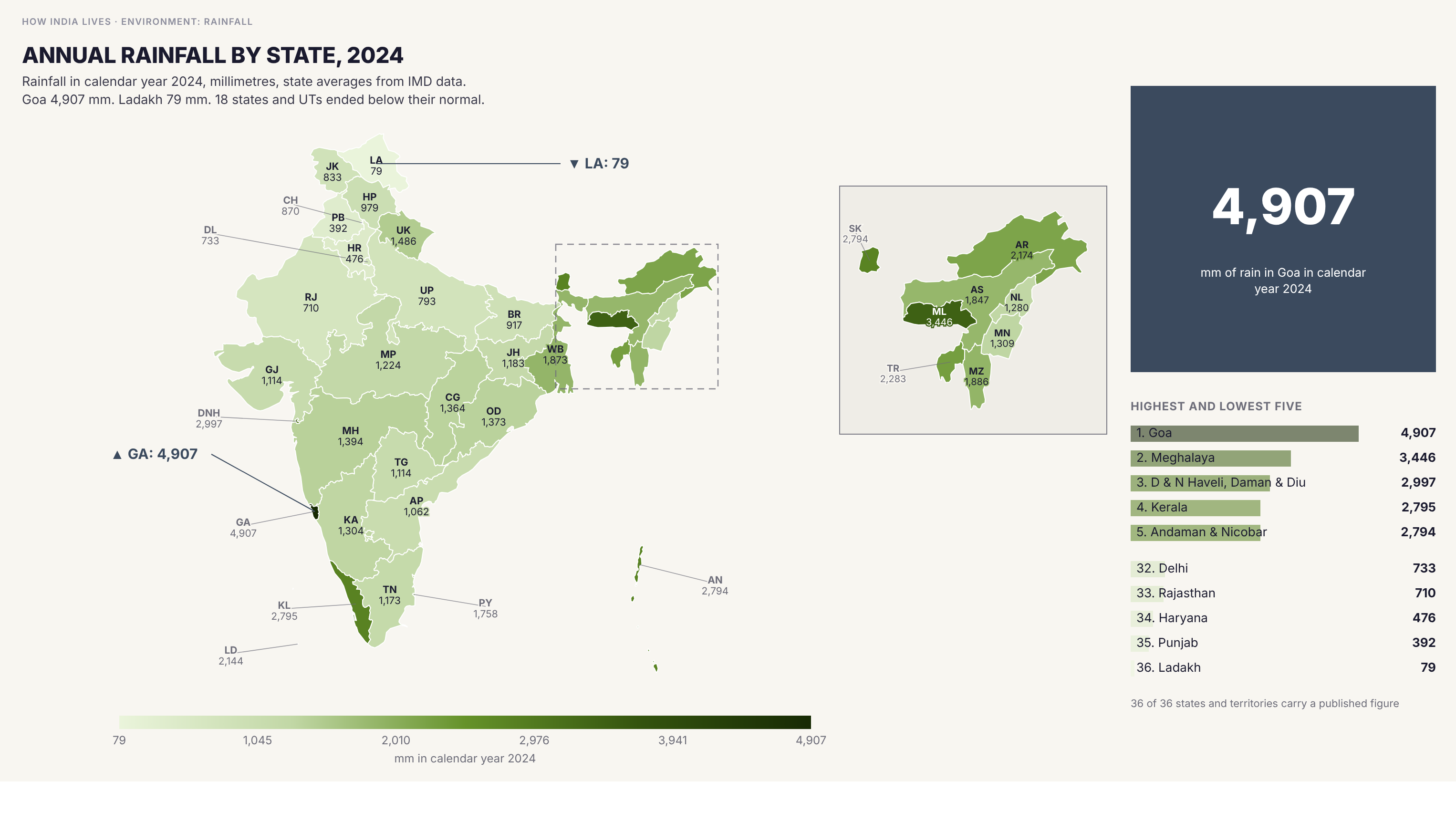
Goa received 4,907 mm of rain in 2024, the most of any state or territory, followed by Meghalaya (3,446 mm) and Dadra and Nagar Haveli and Daman and Diu (2,997 mm). Ladakh received 79 mm. Eighteen states and territories were below normal, among them Punjab (392 mm against a normal of 566) and Bihar (917 against 1,164), while Rajasthan (710 against 487) and Gujarat (1,114 against 748) were well above. The earlier map's 11,000 mm for Meghalaya cannot be a state average.
Policy implication
A state average hides the difference between wet and dry districts, and one calendar year is weather and not climate: the same year left Punjab 31 per cent under its normal and Rajasthan 46 per cent over. The figures are the Central Ground Water Board's tabulation of India Meteorological Department data for its groundwater assessment, so they follow the board's state list.
A state average hides the difference between wet and dry districts, and one calendar year is weather and not climate: the same year left Punjab 31 per cent under its normal and Rajasthan 46 per cent over. The figures are the Central Ground Water Board's tabulation of India Meteorological Department data for its groundwater assessment, so they follow the board's state list.
Data vintage. The figures are for 2024 and have not been refreshed since this map was made.
Source: IMD via CGWB National Compilation 2025 (2024). See the methodology for notes and limitations.
Part of ImpactMojo. Maps are pedagogical tools for facilitated discussion, not standalone data references. CC BY-NC-SA 4.0.