Women Who Make Financial Decisions Alone or J
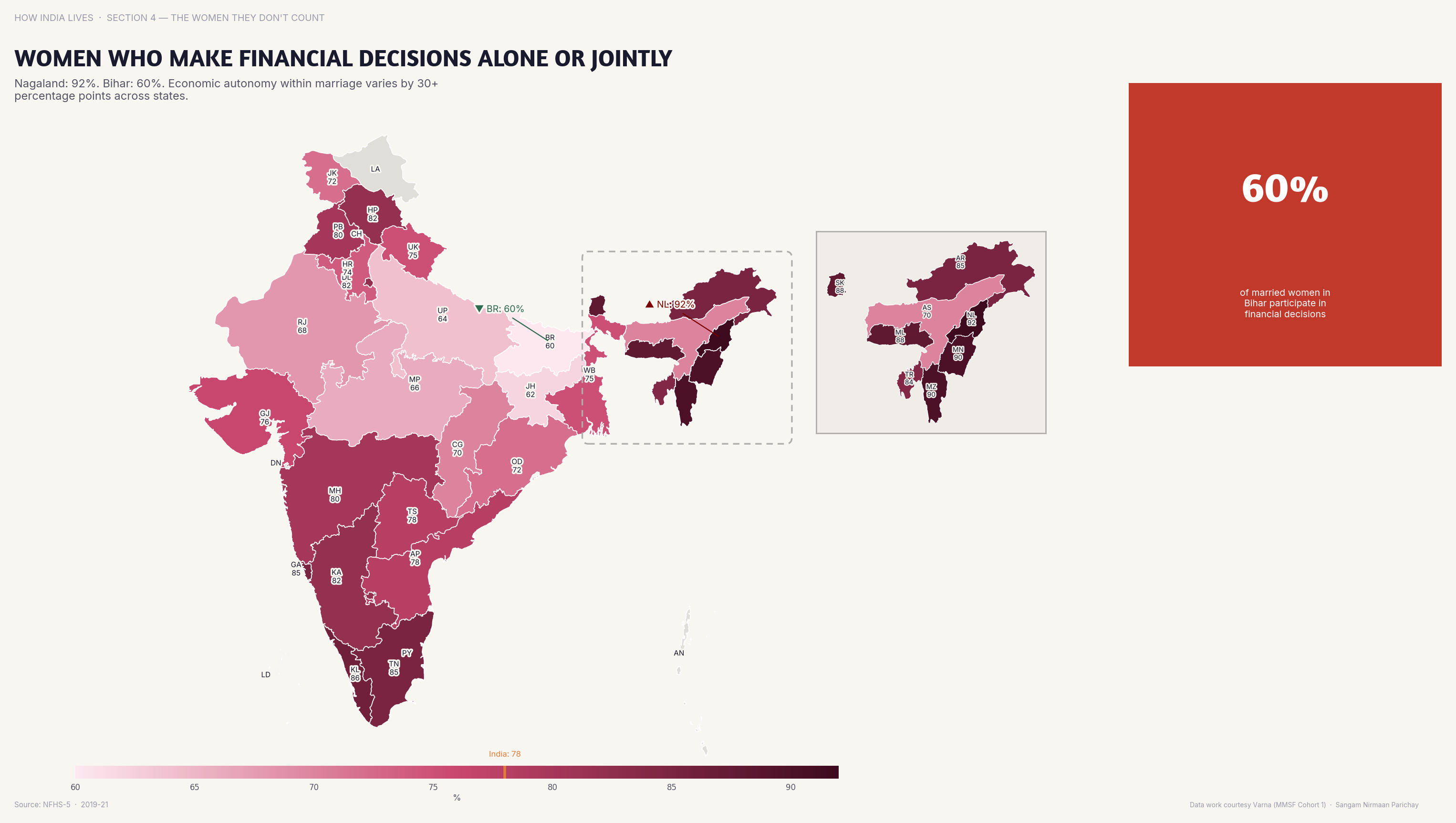
In southern states, 80%+ women participate in household financial decisions; in Bihar, under 40%.
Policy implication
Women's financial decision-making is a gateway indicator — it predicts savings, child nutrition, and education investment.
Women's financial decision-making is a gateway indicator — it predicts savings, child nutrition, and education investment.
Data vintage. This map uses NFHS-5 (2019-21). NFHS-6 (2023-24) state fact sheets were released in May 2026, but they are provisional and report fewer indicators, so the figures here have not been replaced. See the newer figures for this measure in the interactive atlas.
Source: NFHS-5/NCRB (2019-22). See the methodology for notes and limitations.
Part of ImpactMojo. Maps are pedagogical tools for facilitated discussion, not standalone data references. CC BY-NC-SA 4.0.