Creches per Lakh Working Women
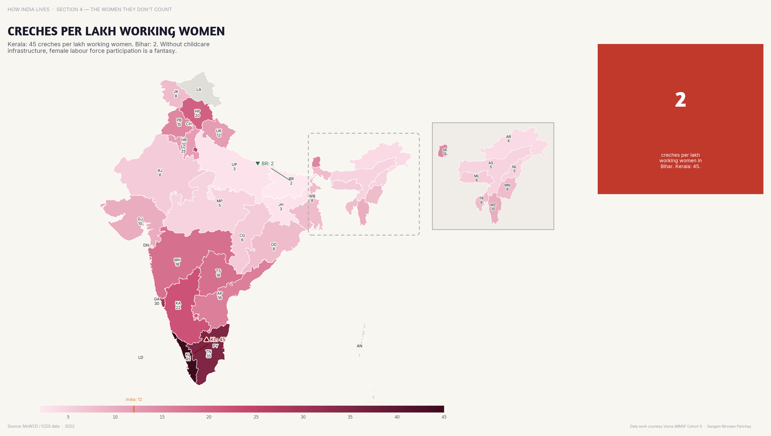
Creche availability per working women varies enormously — childcare is India's missing infrastructure.
Policy implication
Without affordable childcare, women either don't enter the workforce or leave when they have children.
Without affordable childcare, women either don't enter the workforce or leave when they have children.
Data vintage. This map uses NFHS-5 (2019-21). NFHS-6 (2023-24) state fact sheets were released in May 2026, but they are provisional and report fewer indicators, so the figures here have not been replaced.
Data note. This map draws on NFHS-5 and a second source recorded as NCRB. NFHS-6 does not repeat the survey measure, so the combined figure has not been rebuilt and remains as made in 2019-22.
Source: NFHS-5/NCRB (2019-22). See the methodology for notes and limitations.
Part of ImpactMojo. Maps are pedagogical tools for facilitated discussion, not standalone data references. CC BY-NC-SA 4.0.