Remittance-Dependent States
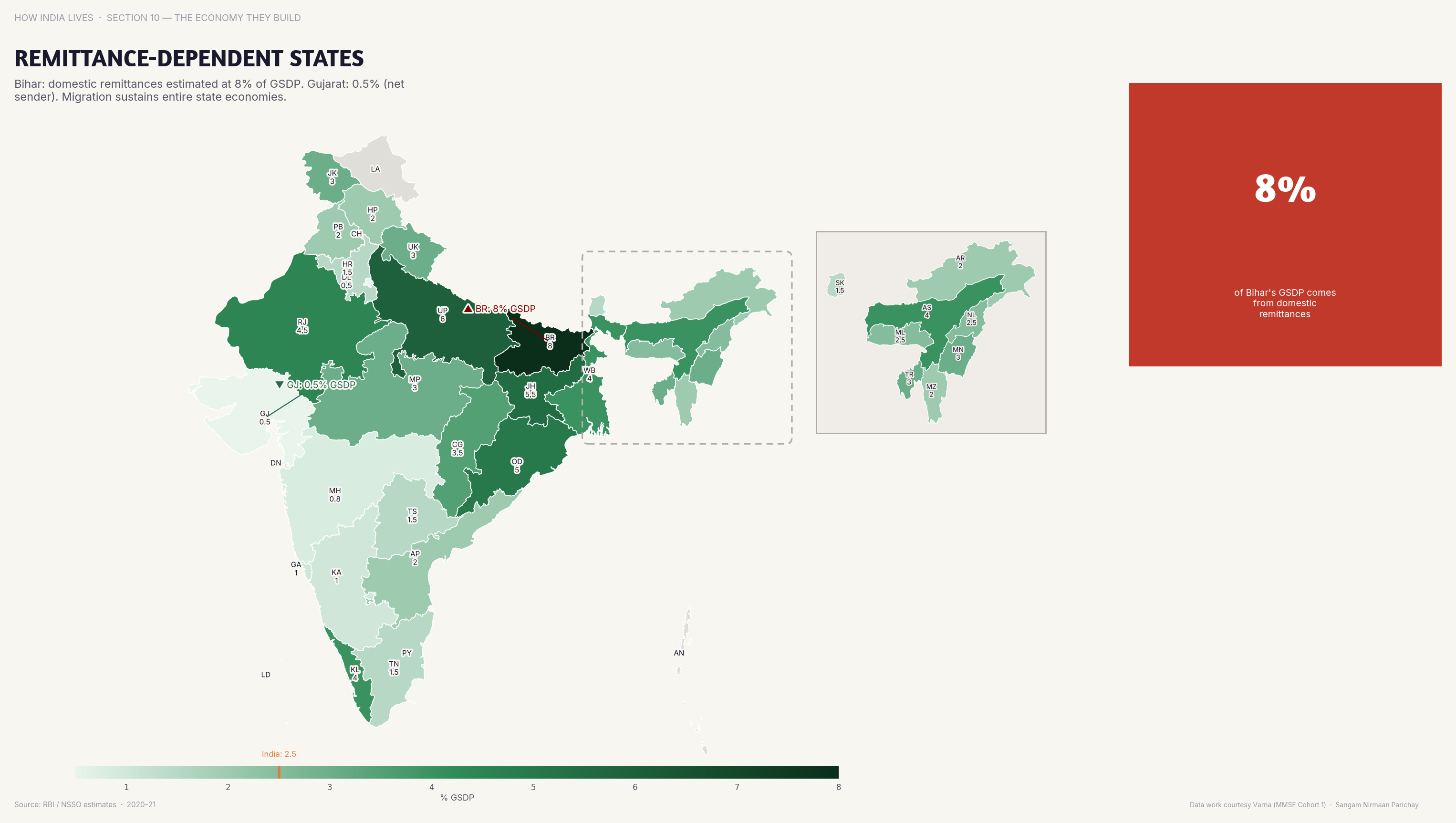
Bihar and UP are the most remittance-dependent states — migrant earnings prop up rural consumption.
Policy implication
Remittance dependence signals local job failure; when destination cities slow down, origin states face consumption crashes.
Remittance dependence signals local job failure; when destination cities slow down, origin states face consumption crashes.
Data vintage. This map uses the 2011 Census, the latest published count by state and district. Populations and shares will have changed since. See the newer figures for this measure in the interactive atlas.
Source: RBI/Census (2017). See the methodology for notes and limitations.
Part of ImpactMojo. Maps are pedagogical tools for facilitated discussion, not standalone data references. CC BY-NC-SA 4.0.