Agricultural Mechanisation Tractors per 1000
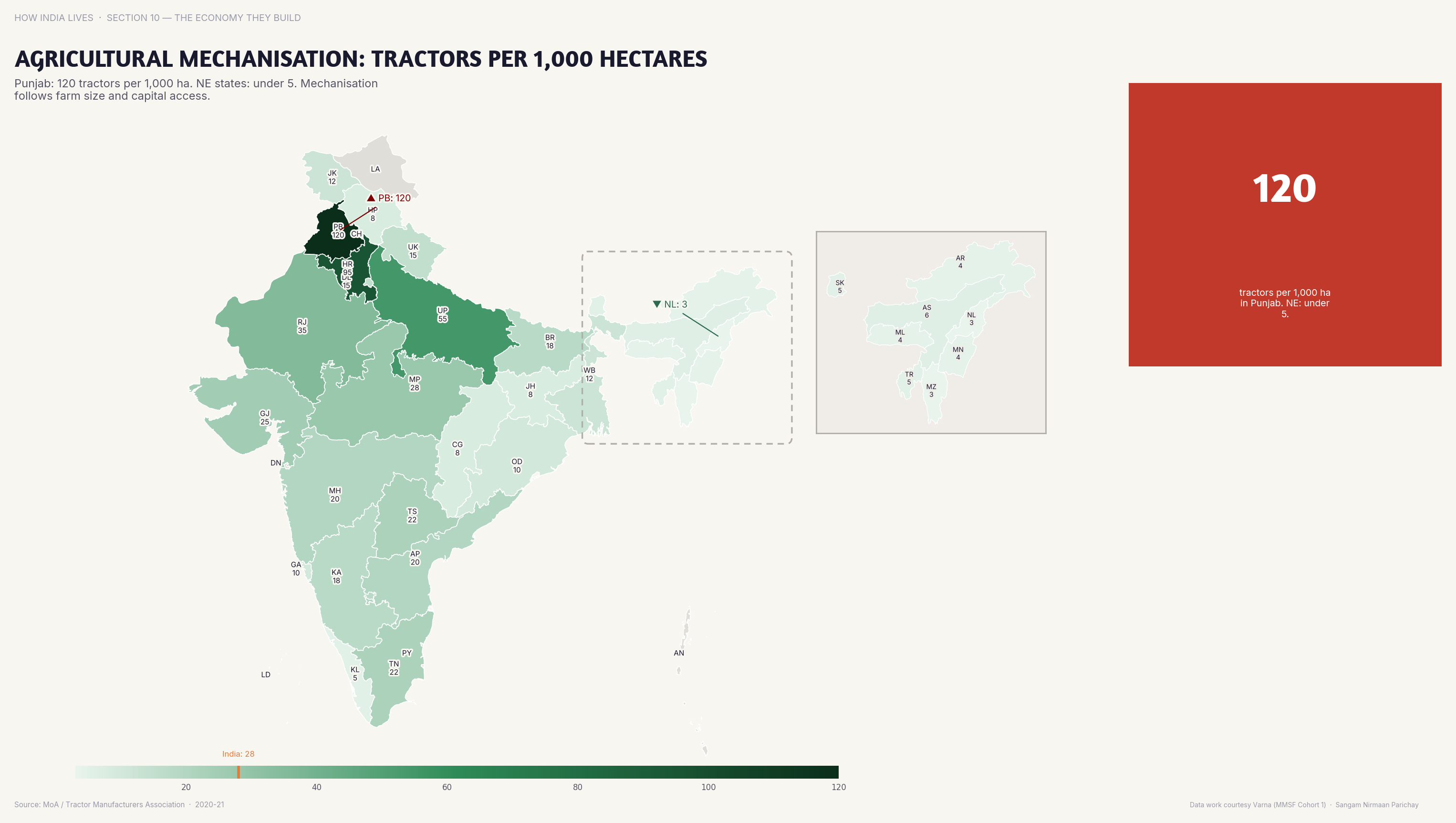
Punjab has 100+ tractors per 1,000 hectares; eastern states have under 10.
Policy implication
Agricultural mechanisation follows landholding size — marginal farmers can't afford tractors, deepening the productivity gap.
Agricultural mechanisation follows landholding size — marginal farmers can't afford tractors, deepening the productivity gap.
Data vintage. This map uses the 2011 Census, the latest published count by state and district. Populations and shares will have changed since.
Source: Agriculture Census (2021). See the methodology for notes and limitations.
Part of ImpactMojo. Maps are pedagogical tools for facilitated discussion, not standalone data references. CC BY-NC-SA 4.0.